
The curious way to fly
Your flight.
Beyond the
blue dot.
A map of the journey. The science behind the signal. A feel for the air ahead. Landblink brings your phone’s sensors, satellites and flight history together, wherever you’re sitting.
Made for the curious.

The journey deserves
some attention.
There’s a lot happening between takeoff and touchdown. See where you are, understand what your phone is measuring, and save the story of how you got there.
A companion for
the in-between.
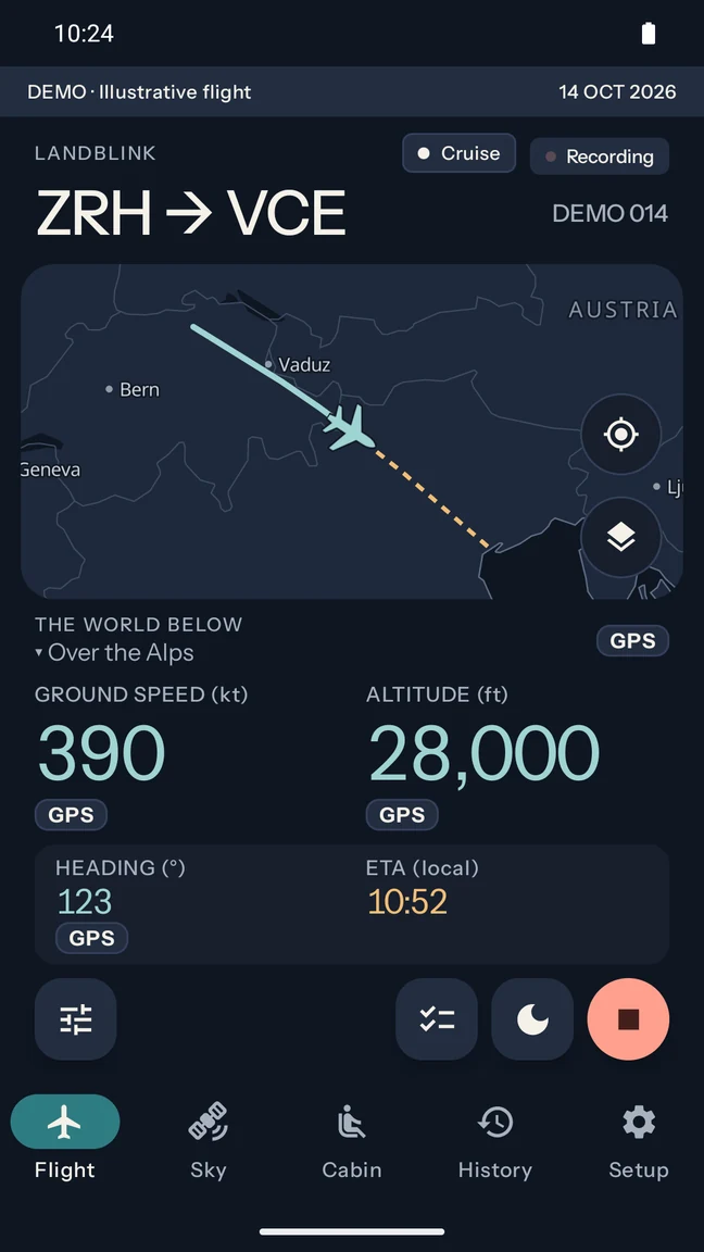
Your route, speed, altitude and arrival estimate, together at a glance. Offline maps and place names give your position context. Measured readings and estimated positions have their own clear labels.
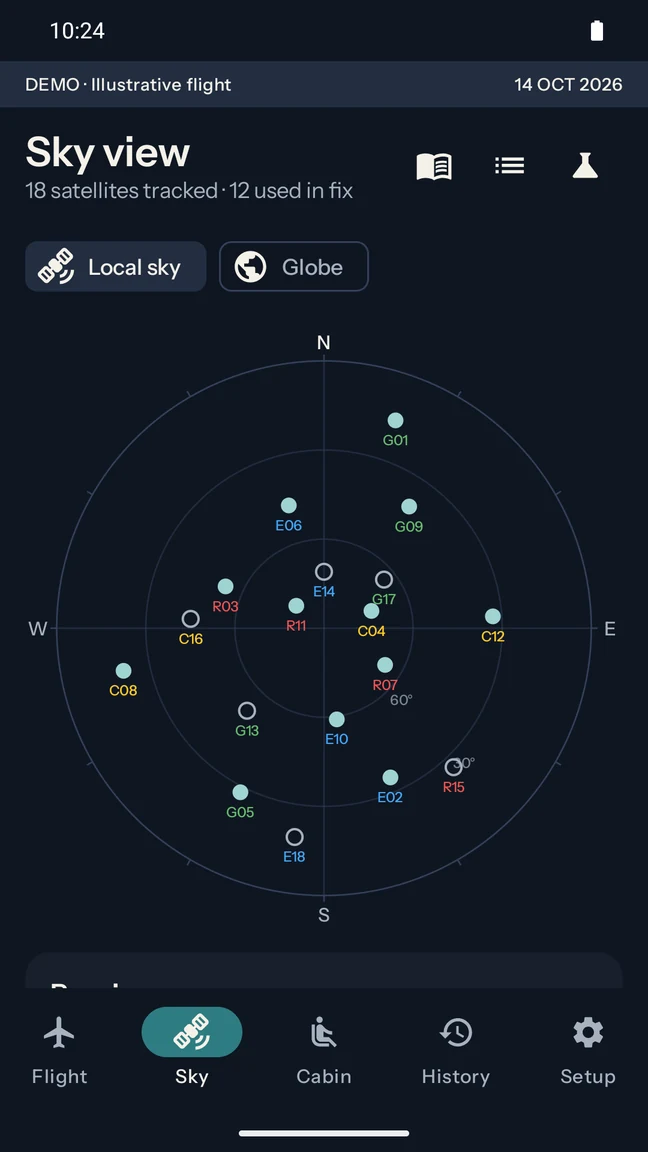
See the satellites your phone can hear, the signals it is using, and how they are arranged above you. Explore the constellations behind a position that can otherwise feel like magic.
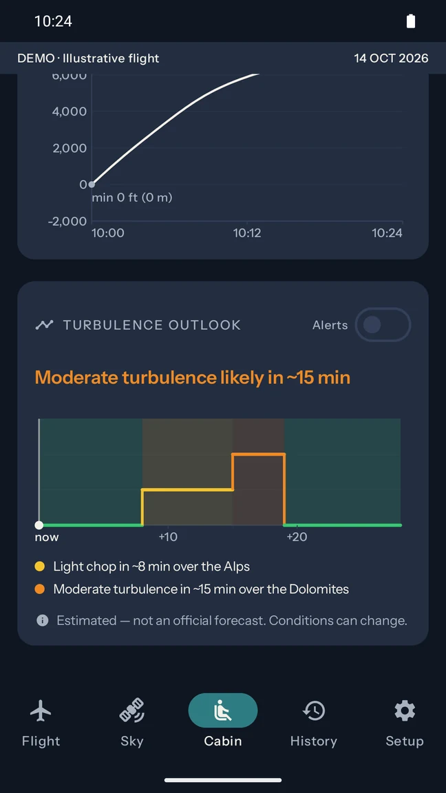
A weather-based outlook follows the route and the expected time you will reach it. See estimated rougher patches, winds aloft and how far ahead they are. Sync before departure to carry the forecast with you offline.
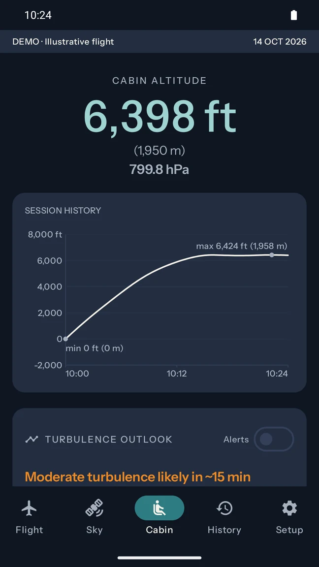
When your phone has a barometer, Landblink turns pressure into cabin altitude and charts how it changes. A sustained pressure trend can reveal the cabin’s descent. Cabin altitude is distinct from the aircraft’s altitude.
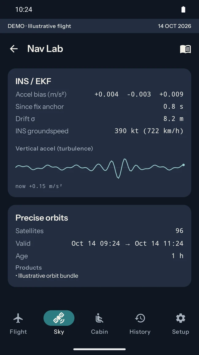
Watch vertical acceleration as the phone measures it. Nav Lab makes the hardware visible: sensor drift, signal quality and an independent raw-satellite position solve. Motion readings include movement of the phone itself.
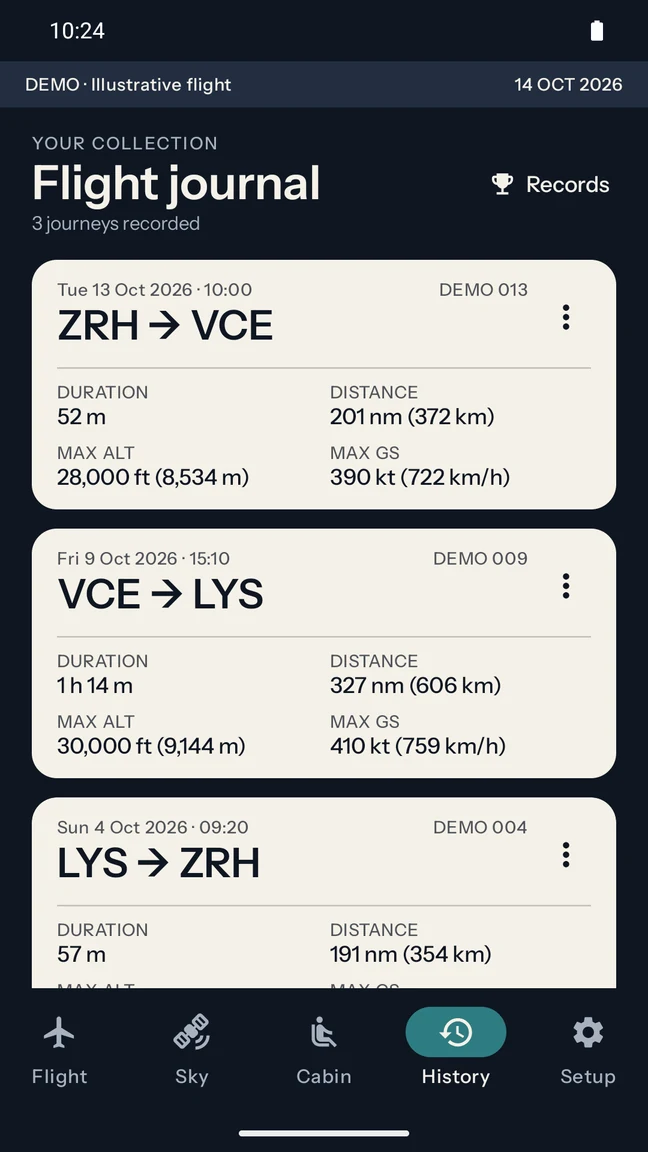
Revisit recorded routes, speed and altitude profiles, and the places you passed. Compare familiar flights, replay a journey, or export your track as GPX. Your recordings stay on your phone unless you choose to contribute.
Actual app screens, fictional journeys. Every sample shown here is created for the demo, never taken from a passenger’s flight history.
Airplane mode.
Curiosity on.
More of your phone. More of the picture.
The live map uses the phone’s satellite position, with clearly labeled fallbacks when reception fades. In Nav Lab, an independent solver works directly with raw measurements, precise orbit data and clock and atmospheric corrections. For compatible GPS and Galileo signal pairs, it also corrects ionospheric delay.
A whole sky of signals.
GPS, Galileo, GLONASS and BeiDou feed the independent positioning engine. The sky view also displays QZSS, NavIC and SBAS when the phone reports them. Each system stays identifiable, so you can see what is tracked and what is actually used.
The signal fades. The story continues.
The accelerometer and the phone’s rotation sensor help bridge brief gaps between satellite fixes. A Kalman filter anchors those estimates to measured GPS positions and tracks drift. An estimate is always labeled as an estimate; it never becomes a measured personal record.
Past flights give the next one context.
Your own recordings and available community routes give a flight context. Landblink combines typical journey duration with your recent ground speed to refine arrival estimates. Historical tracks add a route reference, and familiar journeys can show whether you are ahead of or behind the usual pace.
A forecast for the ride. A trace of the bumps.
Weather downloaded before departure powers an offline turbulence outlook along the route, based on wind shear and convection. Separately, Nav Lab plots the vertical acceleration the phone measures, so you can see motion as it happens. The outlook is an estimate; moving the phone also affects its motion readings.
For the extra curiousHow much sky makes a position?
An interactive experiment with satellite geometry.
How much sky makes a position?
An interactive experiment with satellite geometry.
The landscape behind the page drifts at two speeds and changes scene from section to section as you scroll.
Remove a satellite or a whole constellation. Watch the geometry change. This experiment uses public orbital data over Tel Aviv at 06:00 UTC on 7 September 2026; it is neither a live feed nor a passenger recording. It illustrates geometry, not a promise of positioning accuracy.
Look up from the centre. The edge is the horizon; the centre is directly overhead.
The shaded edge is below the minimum elevation.
DOP describes the effect of satellite geometry on error. Lower is better; these values are not metres.
solvable — 35 spare
Three of position, and one receiver-clock bias for every constellation in the solve — plus one measurement to spare, always. Take satellites away and watch what the geometry costs.
Good
questions.
Does it work in airplane mode?
The bundled map, airports, place names and recordings work without internet. Positioning still needs satellite reception, which varies by device and cabin conditions. Sync orbit and route weather data before departure; weather outlooks only cover the route and time window downloaded.
How accurate is the position?
Accuracy depends on the phone, available signals and conditions. The live position uses the phone’s satellite fix and clearly labeled fallbacks. Nav Lab separately computes a position from raw satellite measurements. Landblink shows the source and uncertainty of readings rather than promising one accuracy figure for every flight.
Does it use every satellite system?
The sky screen can display GPS, Galileo, GLONASS, BeiDou, QZSS, NavIC and SBAS when supported by your receiver. The independent raw-measurement solver currently combines GPS, Galileo, GLONASS and BeiDou. Tracked does not automatically mean used in that calculation.
Can it predict every patch of turbulence?
No. The weather-based outlook estimates conditions along the synced route; it is not an official forecast and conditions can change. The phone’s vertical-acceleration graph shows local motion, not a certified turbulence measurement. Always follow the crew’s instructions.
What happens to my flight history?
Your recordings live on your phone. Contributing flights to improve shared route information is optional and off by default. You can replay recorded journeys and export tracks as GPX. See the privacy policy for details.
When can I get it?
Landblink is being prepared for Google Play. The listing is not live yet. This page will link to the store once it is available.
Bring your curiosity.
Landblink is getting ready for Google Play. Explore the app here while we prepare for takeoff; the store link will appear when the listing is live.